Travel/Public Service · NEWS EXPLAINER
Hurricane Polo: September 27 Warnings for Baja California Sur
Polo remained a 120-mph Category 3 hurricane Sunday morning as warnings covered both sides of Baja California Sur. The NHC urged preparations to be completed, while Los Cabos travelers faced airline change options.
Weather snapshot: September 27, 2026, 5 a.m. MST (12:00 UTC). The warnings, 120-mph wind estimate and track forecast below refer to that advisory, not live conditions. Check the newest NHC bulletin and local instructions before acting.
Hurricane Polo remained a 120-mph Category 3 storm early Sunday as it moved north-northwest toward Baja California Sur, according to the National Hurricane Center's 5 a.m. MST intermediate advisory. Hurricane warnings were in effect along stretches of both the peninsula's west and east coasts, and the NHC said preparations in the warning area should be completed quickly.
For travelers, the storm is already more than a forecast-track story. American Airlines lists Los Cabos/San Jose del Cabo (SJD) under a Hurricane Polo travel alert for eligible September 27-28 trips, allowing a one-time change under the carrier's stated conditions. Anyone traveling to the region should check the latest NHC advisory and their airline rather than relying on an older itinerary.
Warnings cover both sides of Baja California Sur
The NHC's Sunday morning intermediate advisory kept hurricane warnings in effect on sections of both the west and east coasts of Baja California Sur. Polo was moving north-northwest at about 10 mph, and the forecast called for the center to approach the peninsula's west coast on Monday before moving across the peninsula Monday night.
That forecast is not a promise of an exact impact point or timing. Small track or intensity changes can shift where the strongest winds and coastal effects occur, so people in the warning area should use the latest official advisory rather than a static map or an earlier forecast.
Rain, surge and surf are major hazards beyond the wind speed
The NHC said 4 to 8 inches of rain could fall across parts of Baja California Sur, with isolated totals around 10 inches. It warned that the rainfall could produce life-threatening flash flooding and mudslides, particularly in vulnerable terrain.
Coastal risk extends beyond rain. The advisory also warned of storm surge accompanied by large and destructive waves, while swells generated by Polo were expected to create dangerous surf and rip currents along parts of the Mexican coast.
Los Cabos travelers should recheck flights before leaving
American’s alert, dated September 25, covers its SJD flights scheduled for September 27–28 when tickets were bought by September 24. It allows an eligible one-time change for travel September 25–October 2, with changes booked by September 28, unchanged origin and destination, and the same cabin or payment of the difference. The alert also says fare differences may apply.
That waiver does not mean every flight is canceled, and another airline may use different rules. Travelers should verify their operating carrier, airport status and the newest NHC warning before heading to the airport, especially as the storm gets closer to the peninsula.
Open American’s “Find your trip” from the linked alert. An eligible reservation should show “change trip”; if it does not, or the online change fails, contact Reservations through that alert before accepting a fare difference. A change-fee waiver is not a blanket free ticket, refund approval or confirmation of cancellation.
NASA's earlier imagery explains how Polo strengthened so quickly
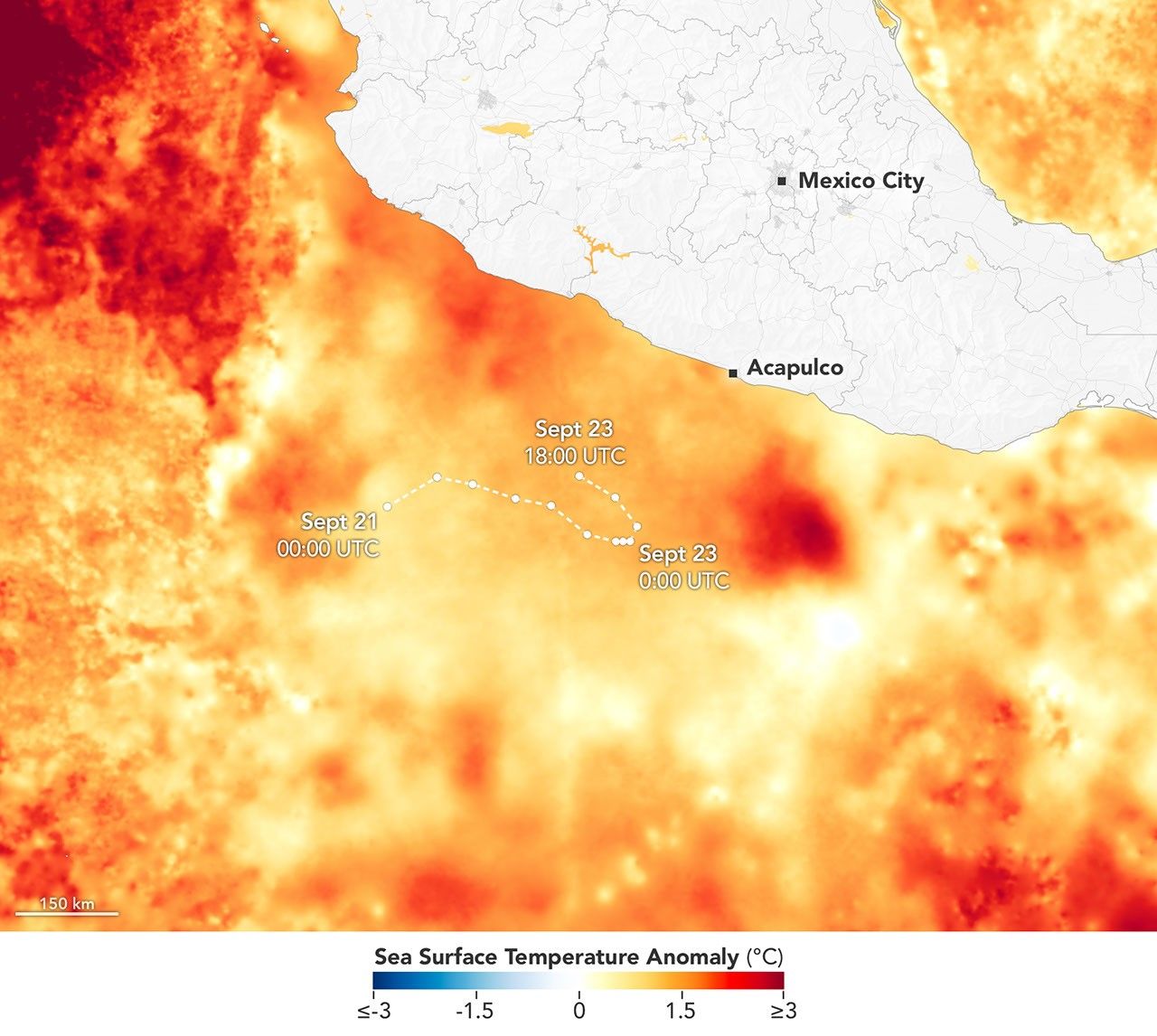
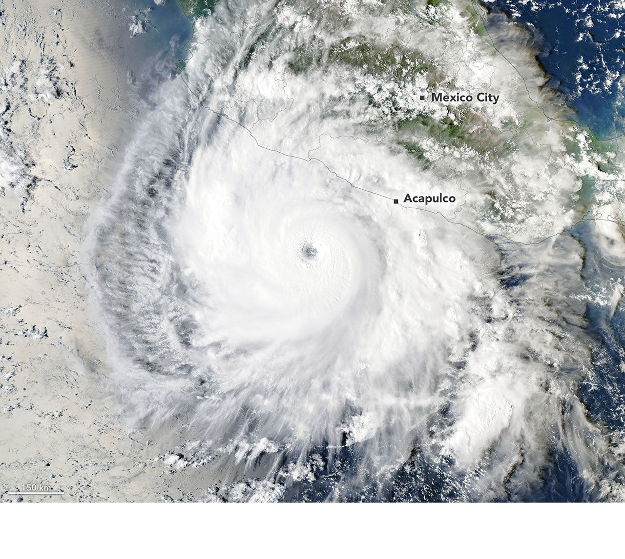
NASA Earth Observatory documented Polo's rapid intensification earlier in the storm's life and highlighted unusually warm ocean conditions that helped support that strengthening. Its September 23 satellite image shows a well-defined eye over the eastern Pacific, while a companion sea-surface-temperature visualization shows the warm-water environment along the storm's earlier track.
Those NASA graphics are useful scientific context, not a current-position map. The article's September 27 warning, wind and hazard information comes from the September 27 NHC advisory, which reflects the storm after it had weakened from its earlier peak.